
EXPEDIENT INDEX
Introduction: The Digital Veil
Hello, and welcome to El Rincón Paranormal. In an age where our reality is increasingly mediated by digital interfaces, the question arises: can the unexplained manifest within the very algorithms that shape our perception? Today, we delve into the unsettling phenomenon of terrifying locations discovered through Google Maps Live, often referred to as "Google Maps Live Coordinates" or "Scary Maps Coordinates." These aren't mere glitches; they are digital specters, anomalies that challenge our understanding of how digital cartography can intersect with the truly bizarre. This isn't about mere entertainment; it's about an analytical dissection of digital echoes that mirror our deepest anxieties.
Algorithmic Anomalies: Ghosts in the Machine
The concept of "ghosts in the machine" has evolved. Once confined to fictional narratives, it now finds fertile ground in the vast, interconnected networks of our digital world. Google Maps, a seemingly mundane tool for navigation, has become an unexpected portal to the uncanny. Users, often by accident, stumble upon coordinates revealing visually disturbing or contextually terrifying scenes. These range from inexplicable natural formations that resemble monstrous entities to oddly placed structures or desolate landscapes that evoke a primal sense of dread. The immediate question for any serious investigator is: are these random occurrences, deliberate hoaxes, or something else entirely?
We must first approach this phenomenon with rigorous skepticism. The algorithms that power Google Maps are complex, relying on satellite imagery, aerial photography, and user-generated data. Errors, incomplete data sets, and peculiar lighting conditions can all contribute to visual artifacts that, when viewed out of context, can appear deeply unsettling. However, the sheer volume and recurring nature of these "terrifying coordinate" discoveries warrant a closer look. It’s akin to finding what appears to be a fleeting apparition in a series of photographs – initially dismissed as dust or lens flare, but persistent instances demand a deeper investigation.
"The digital realm is not sterile. It's a reflection, often distorted, of the physical world and the collective human psyche. Its anomalies are not just errors; they are whispers from the unknown." - Alejandro Quintero Ruiz
When a string of coordinates consistently leads to imagery that evokes fear – perhaps a desolate, abandoned structure that appears to be actively watching, or a natural landscape contorted into an unnerving figure – we move beyond simple algorithmic error. We enter the realm of interpretative anomalies, where the viewer's subconscious projects meaning onto ambiguous digital data. This does not negate the potential for genuine paranormal or unexplained phenomena, but it frames the investigation. Our task is to sift through the digital detritus, separating subjective fear from objective anomaly.
Case Studies: Unsettling Discoveries
The internet is replete with compilation videos and blog posts detailing “scary Google Maps coordinates.” While many are clearly fabricated or misinterpretations, a few stand out due to their consistent disturbing elements and the sheer implausibility of simple error or satire. These are the cases that demand our attention, not for sensationalism, but for the questions they raise about our digital cartography.
The "Face" of the Desert
One recurring discovery involves geographical formations that bear an uncanny resemblance to human or monstrous faces. Often found in arid, remote regions, these "faces" are typically the result of natural erosion patterns. However, the sheer precision and scale of some of these formations have led many to speculate about artificial origins or, more esoterically, terrestrial entities manifesting through geological processes. The question here is not whether it is a 'real' face, but why nature, or something else, would sculpt such disturbing visages in the lonely expanses of our planet.
The "Ghost Town" Phenomenon
Numerous satellite images reveal what appear to be abandoned towns or settlements, often with unusual geometrical layouts or seemingly deserted structures. While many are verifiable abandoned locations, some exhibit characteristics that defy simple explanation. Are these echoes of forgotten settlements, or are some of the "structures" merely peculiar geological formations or data artifacts that our pattern-seeking brains interpret as buildings? The psychological impact of viewing such spectral vistas from above cannot be understated. It taps into our fear of desolation and the unknown fates of those who once inhabited these places.
Unidentified Structures and Anomalous Zones
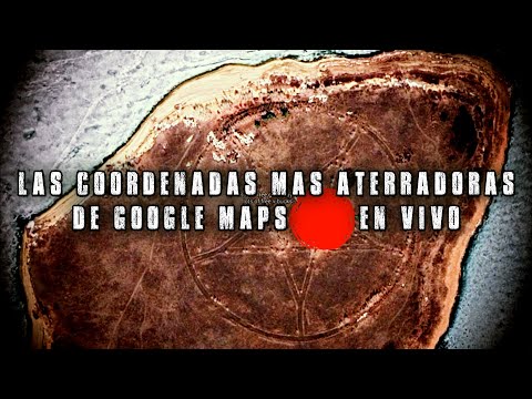
Beyond recognizable formations, there are reports of unidentifiable structures or unusually uniform areas that defy logical explanation. These might appear as perfect circles in otherwise chaotic terrain, or geometric patterns that seem out of place in natural landscapes. While some are likely military installations or unique geological phenomena, others remain stubbornly cryptic. Could these be remnants of unknown activities, or digital misinterpretations of complex earthly features? The lack of clear identification fuels speculation about hidden projects or entities that prefer to remain unseen by terrestrial observation.
Investigator's Protocol: Decoding the Digital Footprint
Analyzing these "terrifying coordinates" requires a methodical approach, moving beyond mere observation to critical investigation. The first step, as always in paranormal research, is to exhaust all mundane explanations. This involves:
- Verification of Location: Confirm the exact coordinates and cross-reference them with multiple mapping services (Google Earth, Bing Maps, etc.) and photographic sources (historical aerial photos, user submissions). Is the anomaly consistent across different data sets?
- Contextual Analysis: Research the geographical and historical context of the area. Are there local legends, reports of unexplained phenomena, or known historical events associated with the location? This involves delving into archives, local folklore databases, and historical records.
- Algorithmic Consideration: Understand potential sources of digital distortion. Factors like satellite resolution, image stitching errors, unusual atmospheric conditions, or even deliberate obfuscation by mapping services can create misleading visuals.
- Pattern Recognition: Compare the anomalous feature to known geological formations, meteorological phenomena, and man-made structures. Consult geological surveys and expert opinions where possible.
- Investigating User-Generated Content: Examine claims made by those who first reported the anomaly. Are their testimonials consistent? Is there evidence of manipulation or misinterpretation in their original footage or screenshots?
The use of specialized tools is paramount. High-resolution imagery, spectral analysis (if available), and comparing older imagery to newer data can reveal changes over time, hinting at the nature of the anomaly. For serious investigators, acquiring access to raw satellite data or specialized mapping software can provide deeper insights than standard consumer-grade applications. This is where the investment in tools, akin to acquiring a reliable EMF meter or an EVP recorder, becomes crucial for serious analysis.
Investigator's Verdict: Shadows in the Satellite Data
After careful analysis, the phenomenon of "terrifying Google Maps coordinates" presents a complex duality. On one hand, the overwhelming majority of these discoveries can be attributed to the confluence of natural geological processes, algorithmic interpretation errors, and the potent human tendency towards pareidolia – seeing familiar patterns in random stimuli. The human mind is wired to find faces and familiar shapes, especially in ambiguous visual information. These digital landscapes offer a vast canvas for such projections.
However, dismissing all reports outright would be a disservice to the spirit of inquiry. A small fraction of these reported anomalies remain stubbornly resistant to mundane explanation. Whether these are truly anomalous topographical features, remnants of forgotten human endeavors, or something more profound interacting with our digital perception remains an open question. The digital veil, while revealing much, also conceals. The coordinates that lead to unease are less about a direct paranormal haunting and more about the intersection of our psychological landscape with the vast, imperfect digital map of our world. The true mystery lies not just in what we see, but in why our minds interpret it as terrifying.
The Investigator's Archive
For those seeking to delve deeper into the intersection of technology, mystery, and the unexplained, several resources are invaluable:
- Books:
- "The Maps of Unknown Places" by Jeremy Stamp: Explores cartographic enigmas and hidden landscapes.
- "The Phenomenon of Man" by Pierre Teilhard de Chardin: Offers a philosophical perspective on humanity's place in the evolving cosmos, relevant to understanding technological perception.
- "The Day After Roswell" by Philip J. Corso: Discusses alleged government cover-ups and classified technologies, providing a context for unusual aerial observations.
- Documentaries:
- "The Phenomenon" (2020): A comprehensive look at the UFO phenomenon, touching on technological aspects and government secrecy.
- "Searching for Sugar Man": While not paranormal, its exploration of mystery and uncovering hidden truths is a parallel for investigative methodology.
- Platforms:
- Gaia: A streaming service with extensive content on paranormal, esoteric, and unexplained phenomena, often featuring analyses of controversial discoveries. (Subscription may be required).
- Academic databases (JSTOR, Google Scholar): For research into geological phenomena, image processing, and the psychology of perception.
Frequently Asked Questions
Q1: Are these Google Maps locations actually haunted?
A1: While the term "haunted" is subjective, many of these locations evoke a sense of unease. However, direct evidence of paranormal activity is typically lacking with purely visual map anomalies. The fear often stems from interpretation and context rather than direct evidence of spectral presence.
Q2: Can Google Maps intentionally hide things?
A2: Google Maps, like any digital platform, can have redactions or blurred areas, often for privacy or security reasons (e.g., military bases). However, these are usually deliberate and clearly indicated. The "terrifying" anomalies are generally not the result of intentional hiding but rather of how data is captured and rendered.
Q3: What's the best way to investigate a strange map anomaly I found?
A3: Start by verifying the coordinates across multiple platforms. Research the local history and geology. Look for similar formations or documented anomalies. Always exhaust mundane explanations before considering paranormal ones. Document your findings meticulously, including screenshots and contextual data.
Your Field Mission
Your mission, should you choose to accept it, is to become a digital cartographer of the uncanny. The next time you're browsing Google Maps, whether for navigation or idle curiosity, pay attention to the peculiar. When you encounter an anomaly that sparks your interest or evokes a sense of dread:
- Document: Take high-resolution screenshots of the location, including prominent landmarks and any identifying coordinates.
- Research: Investigate the geographical context. What is this area known for? Are there any local legends or historical events associated with it?
- Analyze: Consider all possible explanations. Is it natural? Man-made? A digital artifact?
- Share (Responsibly): If you believe you've found something genuinely perplexing, share it with the community, but include your research and analysis. Encourage critical thinking, not just sensationalism.
The digital world is a frontier. Let's map its shadows together and see what truths hide within the pixels.
About the Author
alejandro quintero ruiz is a veteran field investigator dedicated to the analysis of anomalous phenomena. His approach combines methodological skepticism with an open mind to the inexplicable, always seeking the truth behind the veil of reality. With years of experience documenting cases ranging from cryptids to spectral encounters, his expertise lies in deconstructing the extraordinary through rigorous investigation.
The digital realm offers a new frontier for the unexplained. While many anomalies found on platforms like Google Maps can be attributed to natural phenomena or digital quirks, the consistent appearance of unsettling imagery prompts deeper questions. Are these merely visual coincidences, or do they represent a new manifestation of the unknown, reflected in the very code that maps our world?